Land Capability Assessment (LCA)
P-10-compliant agricultural land capability assessments that classify your land's farming potential and stand up to ALC and municipal review.
A Land Capability Assessment classifies your property's agricultural potential under British Columbia's P-10 Agriculture Capability system. We log test pits, survey the soils on site, and map the capability classes across the parcel, with cross-sections to support the findings, the soils evidence a development, subdivision, or ALC file needs. Every assessment is prepared by a Professional Agrologist who reviewed these files from inside the ALC and the City of Richmond.
What's included
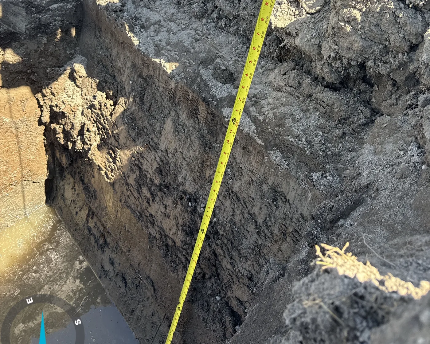
- On-site soil survey with logged test pits documenting horizons, texture, structure, coarse fragments, and observed soil moisture and rooting depth
- P-10 Agriculture Capability classification (unimproved and improved ratings) with subclass limitation codes assigned across the property
- Capability map delineating soil and rating polygons over the parcel, georeferenced to title boundaries
- Representative soil cross-sections illustrating profile conditions and depth relationships at key locations
- Photographic field record of each pit and site condition keyed to map locations
- Plain-language interpretation linking soil properties to agricultural implications and any limiting factors observed
- A signed, P.Ag.-sealed assessment report formatted to support ALC, subdivision, and municipal submissions
- A summary of findings and recommendations written for use in an ALC application or development rationale
What a Land Capability Assessment is
A Land Capability Assessment (LCA) classifies how well a parcel can support agriculture. In British Columbia, that classification follows the provincial Agriculture Capability rating system, commonly referenced as the P-10 standard, which sorts land into Classes 1 through 7 and assigns subclass codes for the factors that limit it. Class 1 carries the widest range of crops with no significant limitations; Class 7 has none. Most Agricultural Land Reserve (ALR) land sits in between, limited by soil moisture, stoniness, topography, fertility, or shallow rooting depth.
An LCA is not a desktop exercise built from old soil maps. A credible assessment is grounded in what the soil actually does on your site, established through field survey and test pits. That evidence is what lets the rating withstand scrutiny when a regulator, neighbour, or opposing consultant questions it.
When you need one
You typically need an LCA when a decision-maker must understand a parcel’s agricultural value before approving a change to it. Common triggers:
- Agricultural Land Commission (ALC) applications, non-farm use, subdivision, exclusion, or boundary adjustment applications within the ALR are often expected to include a soils-based capability assessment.
- Development and subdivision, where a proposal affects ALR land or adjacent land, local governments and the ALC want to know what agricultural capability is at stake.
- Site and master planning, knowing which parts of a parcel hold the strongest capability lets you design around the best soils rather than sterilising them.
- Due diligence before purchase, buyers of ALR land use an LCA to understand what they are acquiring and what the ALR designation means for their plans.
If the ALC or a municipality has asked you for something referencing agricultural capability, soil classification, or a P.Ag. report, an LCA is almost certainly what they want.
How Titrin approaches it
Every LCA follows the same evidence-led method, because that is what makes a report defensible.
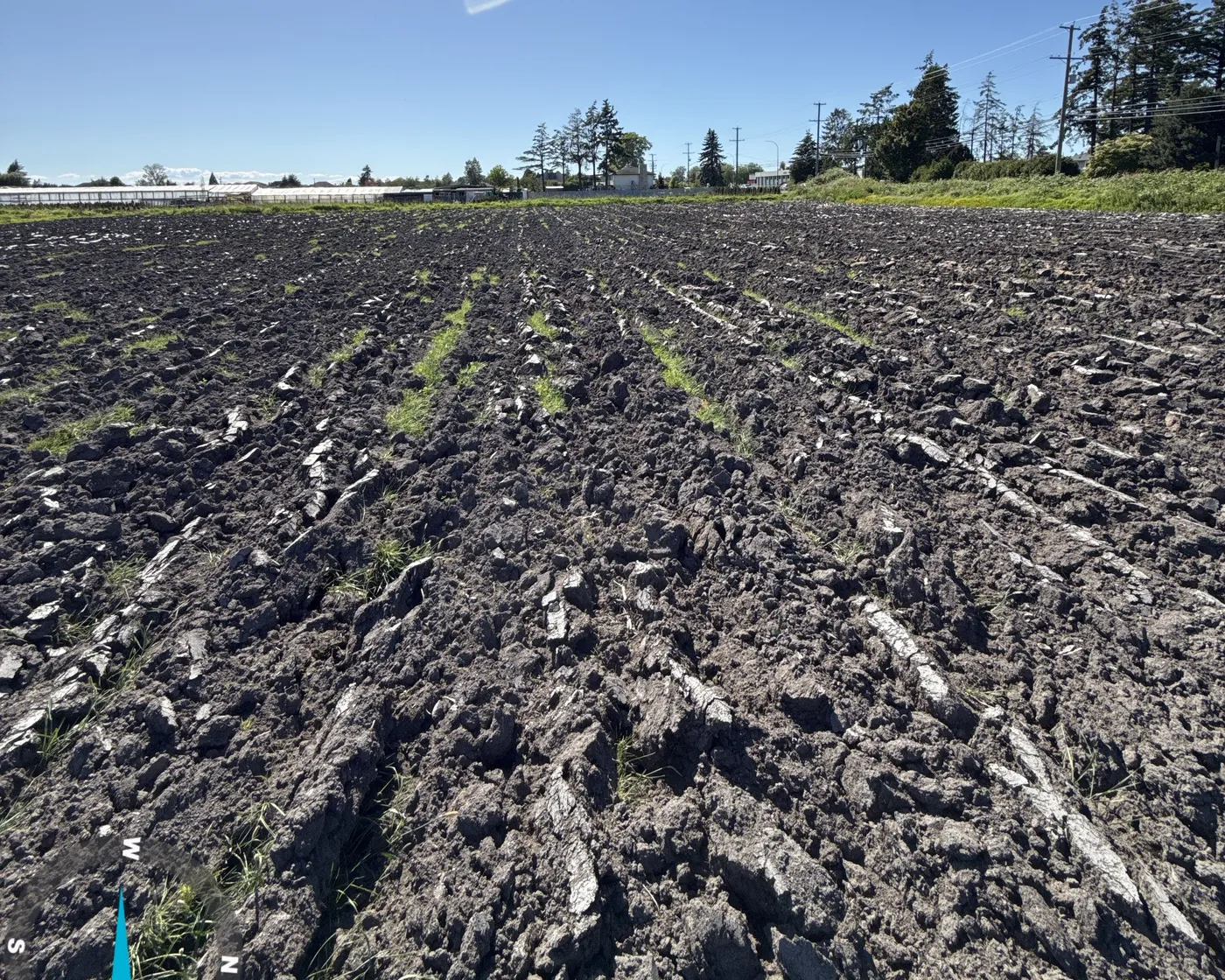
Field survey and test pits. A Professional Agrologist walks the property and excavates test pits at representative locations. Each pit is logged for the characteristics that drive the rating, horizon sequence, texture, structure, coarse-fragment content, rooting depth, and observed soil moisture, then photographed and tied to mapped locations, so any reviewer can trace each finding back to the ground.
Capability classification. From the field data we assign the P-10 rating across the parcel, reporting both the unimproved class (current condition) and the improved class (realistically achievable with sound management), with subclass codes naming each limiting factor. Regulators read this most closely, so the reasoning behind every rating is shown, not asserted.
Capability mapping and cross-sections. We delineate soil and rating polygons georeferenced to the title boundaries and prepare representative soil cross-sections illustrating profile and depth conditions at key points. Maps and sections turn a technical classification into something a planner or commissioner can read at a glance.
Plain-language interpretation. We translate the soil findings into agricultural implications, what the land can and cannot reasonably grow, and why, and frame them to slot directly into an ALC application or development rationale.
A note on scope
Titrin is a Professional Agrologist practice. An LCA covers soil and agricultural assessment, field observation, and capability classification. Drainage is described qualitatively, observed conditions and their agricultural implications, but detailed drainage design, geotechnical engineering, and structural work fall outside agrology and are referred to a qualified engineer. Where a project needs engineered design, we coordinate so the agricultural findings and the engineering line up rather than contradict. Where biology or riparian input is required, we deliver it alongside Registered Professional Biologist (R.P.Bio.) partners. Being clear about these lines is part of what keeps our reports credible with the people who review them.
Why Titrin
A reviewer’s-eye view. Titrin’s principal, Tishtaar (Tish) Titina, P.Ag., M.Sc., spent more than a decade across the Agricultural Land Commission and the City of Richmond before consulting privately. A Titrin LCA is written with a working understanding of how these reports are read, weighed, and challenged on the other side of the table, and built to answer a reviewer’s questions before they ask them.
Defensible, evidence-led findings. The classification stands on logged pits, mapped polygons, cross-sections, and a documented chain of reasoning, the foundation that carries an assessment through regulatory scrutiny.
Direct access to the Professional Agrologist. The person who walks your land and digs the pits is the person who signs and seals the report. No hand-off to a junior you never meet.
Full-cycle delivery. A capability assessment is rarely the end of the story. Because Titrin works across assessment, ALC and municipal permitting, and compliance, your LCA can feed straight into the next stage without re-explaining the file to a new firm.
Titrin completes Land Capability Assessments across Metro Vancouver, the Fraser Valley, and Vancouver Island, from Richmond and Delta through the Fraser Valley and onto the Island. If you are facing an ALC application, a subdivision, or a development on or near ALR land and need the soils evidence to support it, an LCA is the right place to start. To scope an assessment for your parcel, book a consultation.
Frequently asked questions
What is a Land Capability Assessment and why would the ALC or my municipality ask for one?
What does the P-10 capability rating actually tell me about my land?
What happens on site during the assessment?
Does an LCA include a drainage design or geotechnical engineering report?
Do you assess properties outside Richmond?
Related projects
Equestrian Pasture Conversion
Titrin prepared a P-10 Land Capability Assessment for an equestrian property in Langley, supporting an Agricultural Land Commission application to remove peat and place soil so the land could be brought into pasture and broodmare use. The work was led directly by our Principal Agrologist, P.Ag.
View project →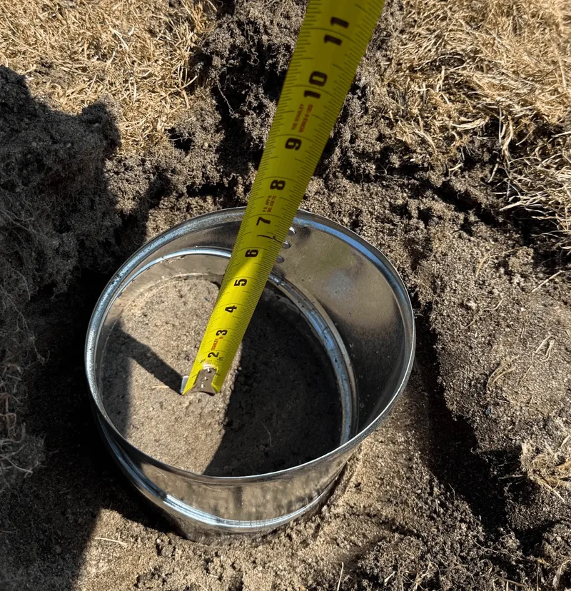
Riverview Baseball Park
Titrin provided independent agrologist services for the construction of new sports turf at Riverview Baseball Park, collecting and analysing soil and root-zone material and issuing stamped specifications under the seal of a Professional Agrologist. The work gave the City of Coquitlam third-party verification that the imported growing medium met the agronomic standard required for healthy, durable playing fields.
View project →
Colwood Creek Park
Titrin provided independent professional review and agrological advisory support to the municipality on an Agricultural Land Reserve (ALR) exclusion application affecting parkland, assessing the land's agricultural capability and the application's standing against Agricultural Land Commission (ALC) considerations.
View project →